 March 28, 2020
 Another opportunity arose to get out to chase storms as the temperatures were in the 70's and storm parameters were forecast to be primed for a major severe outbreak with a high probability of tornadoes. My son Ryan, our friend Tyler Schlitt, and I took advantage and headed north to our target area. Storms were anticipated off of a warm front draped across northeastern Iowa into northern Illinois and down a dryline in eastern Missouri into western Illinois. Lot of discussion was had to determine where to head. Tyler made the suggestion for southeast Missouri while Ryan and I were favoring west central Illinois. We chose not to go further north to the warm front draped in Iowa and far northern Illinois due to the storms quick speeds (60mph) and the fact the storms would be moving further away and creating a longer drive back home. After consulting with our friend Brian Stertz, we settled on a chase target of Springfield, Illinois and would watch the storms that were to form on the dryline to the west. Brian also shared he was concerned that the morning convection that was going through Missouri may hamper the storm parameters that were in place.
We headed for our target in Springfield. As we arrived in Springfield, we made the decision to grab I-72 west as we knew the Springfield target may now be too far east as the system slowed a bit. We stopped in Jacksonville, Illinois to reassess and grab lunch at the Arby's drive thru. Looking at the model data, it continued to show a line of broken supercells down the dryline into eastern Missouri that would then race northeastward toward our location. Model run after model run showed individual storm cells were forecast to come right through the area where we sat. Since it was still mid afternoon, it was a matter of showing patience and not jumping on fast moving storms further away and attempting to play catch up.
As time went on, storms were slow to develop. A PDS (Particularly Dangerous Situation) Tornado Watch was issued for our area along with another tornado watch further south that went all the way down into Arkansas. Eventually we worked our way a bit further west and parked in the Illinois River bottomland to give us a good view to the west of any storm development as we waited.
A storm finally did get rooted up to our north near Quincy, Illinois and raced northeast, but the storm was too far away and moving too quickly for us to intercept it. Our friend Nick Pavlovits who we had also been in communication with us throughout the day, had chosen his target area near Quincy, Illinois and was able to latch onto this storm. That storm became tornado warned and eventually did put out a confirmed tornado. Back where we were, there was a bit of development further southwest of that cell northeast of Quincy. These storms were occurring out ahead of the approaching dryline to our west, but none of these we were watching could seem to get their act together.
Minor pulses would keep giving us hope with these storms and then fade away. These storms moved off and then it was a waiting game again.
There was still hope that more development would occur right on the dryline as it approached. As evening came, this new line of storms finally began to bubble up.
Again, just like the storms prior, the storms bubbled and would fade. We had a great view under the updrafts and a few times during the development would see slight lowerings and wispy fingers, but nothing that appeared to come anywhere near what we were hoping we would see.
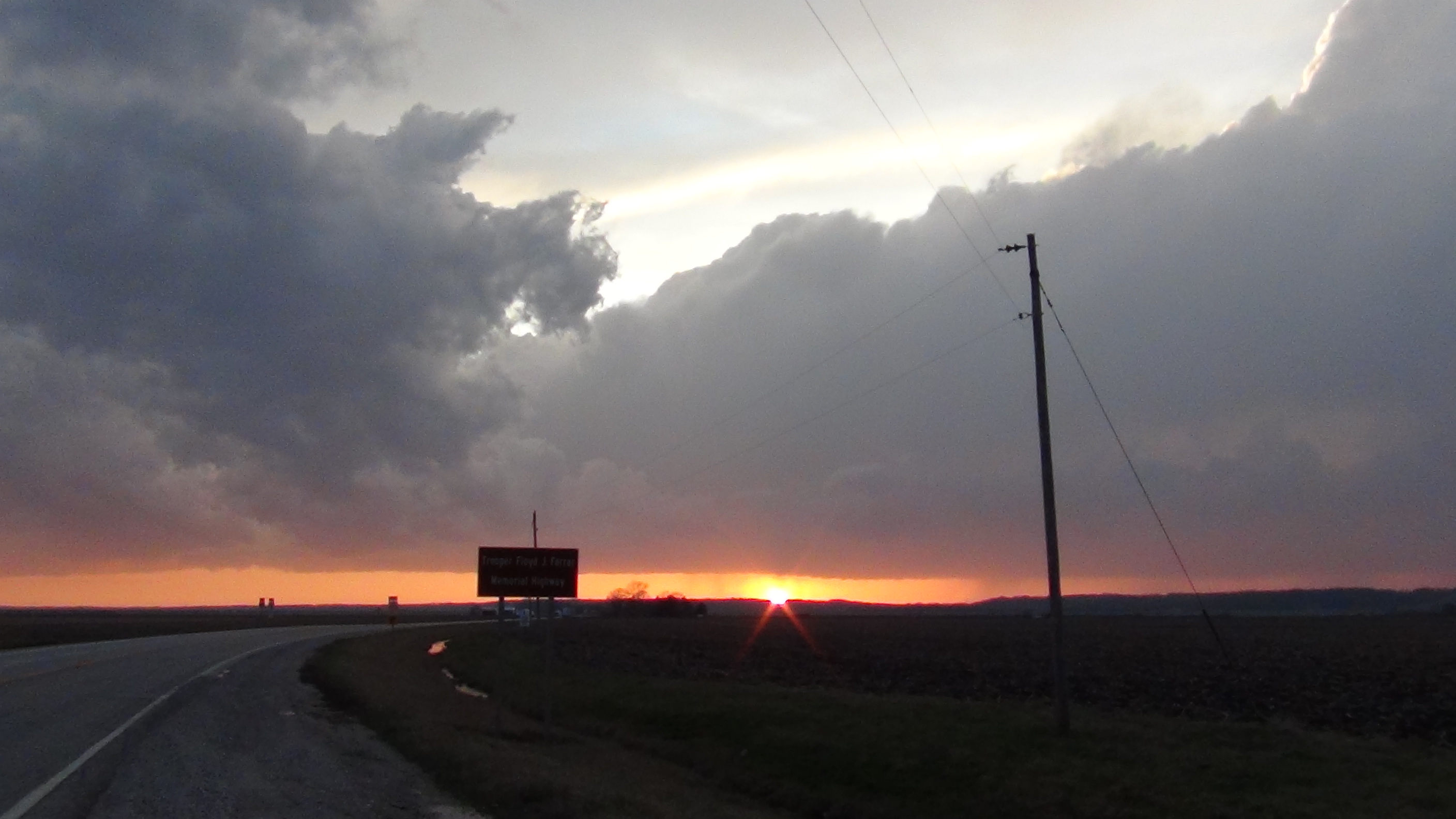
As the sun set, so did our hopes. Did see a nice Crepuscular Ray near sunset to give us a little photo consolation.
As if right on cue, after the sun set, the storms ramped up and quickly intensified into a line of storms. We followed along side of the line of storms for a while after dark as the bases were very visible. The lightning became more frequent and there were even a few more tornado warnings in the line as it moved off to our north, but once again, the warnings were too far away and out of our range due to the storm speeds.
Today was one of those days where making a slight error in a target would put you in a place to not see a storm due to the very fast storm speeds. Unfortunately for us, we were never able to get under a severe warned storm. Thus we saw no hail, no severe wind, and not even a wall cloud.
Special Thanks to Brian Stertz and Nick Pavlovits for their real time information and data today. Also thanks to our chase partner today, Tyler Schlitt, for the use of some of his photos in this story.
11.5 Hours - 253 Miles


|
Click
on the link below to see video of some of these
storms.
|
|
Summary 2020 Page |
Return
to the Storm Index Page |