 September 16, 2006
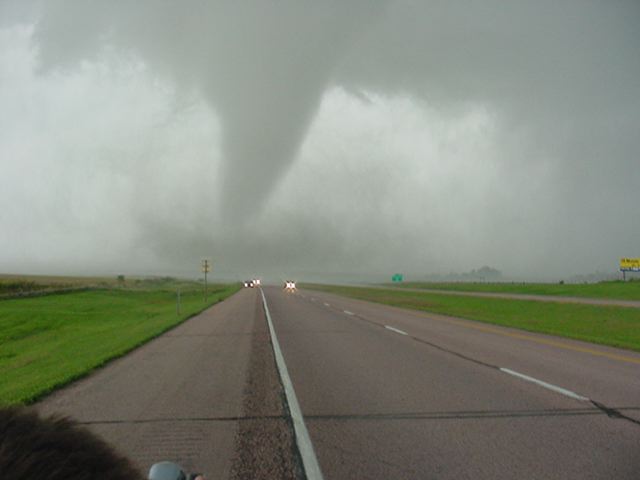
 National Weather Service Survey & MapsMy son Ryan and I met up with Brian Stertz and we drove to our target area around the IA, NE, SD border intersection. The Storm Prediction Center had a Moderate Risk with a 15% hatched area for Tornadoes.
The storms developed in the early afternoon and Brian had us on top of the cell of the day in McCook County South Dakota as it began to tornado. We watched the full cycle of the 20 minute long tornado including the Tornado crossing Interstate 90 (pictures 1-5). Then we tracked down a second tornado (picture 6) and saw it destroy a few farm outbuildings in Minnehaha County South Dakota. Best chase of the year.


 |
 |
 |
 |
<>>
| allowfullscreen="" frameborder="0" height="315" width="560"> |
|
Click
on the link below to see video of some of
these storms.
|
|
Summary 2006 Page |
Return
to the Storm Index Page |