Took
a trip up to Iowa for the storm setup in Southwest
Iowa. Was disappointed that our chase
partner/forecaster Brian Stertz had to sit this one out
because of doctor's orders as he is still in recovery mode
from his medical issue, but Tyler Schlitt and my son Ryan,
and I made up the chase team for the trip.
As we started, we
already had a decision to be made on which direction to go
as there was still indecision whether the storms would
fire near the Nebraska border or more toward the center of
Iowa. Our choices were to go west to Kansas City,
Missouri, then north or go north through Hannibal,
Missouri, then west in Iowa. We made the decision to
go north through Hannibal and then take Highway 34 west in
Iowa. Once we reached Ottumwa, Iowa, we had our
lunch at a Pizza Hut. This being one of our chasing
superstitions, it seems more times than not, eating at a
Pizza Hut produces a tornado for us later in the
day. Would it work today?
After lunch, we
continued west on Highway 34 with now a flexible target of
Osceola, Iowa. That would give us plenty of road
options in every direction. When we got to Osceola,
we chose to continue west toward Creston, Iowa. We
were seeing two areas of interest. An area of
building storms to the southwest coming up from near
Maryville, Missouri and an area of building storms to the
southeast near Bethany, Missouri. Both of these
areas were moving north-northeast toward our general area.

|

|
Maryville,
Missouri Storms
|
Bethany,
Missouri Storms
|
At
this point, it was a waiting game as we watched both
areas. We played in the middle of each of these
areas so we could bolt either direction depending which
set of storms would take the lead. Eventually, the group
of storms coming at us from the southwest began to show
the signs of becoming the more aggressive storms. We
worked our way a bit south to meet these storms and we
were noticing that one area was showing consistent
rotation. We lined ourselves up with the storm and
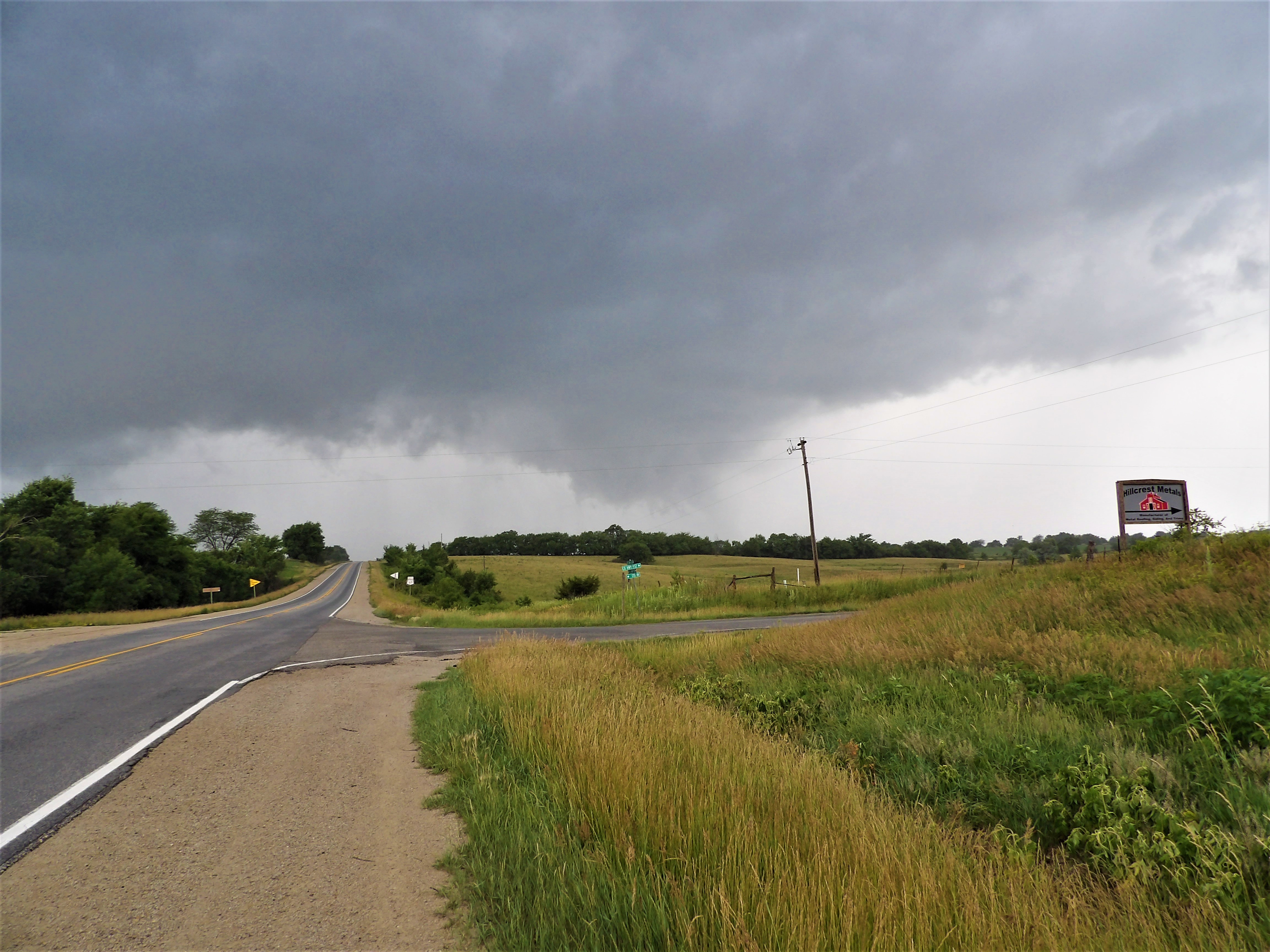
positioned east of Redding, Iowa. The storm wrapped
up and the wall cloud now was dropping a funnel
cloud. Although the base of the storm was hidden by
trees, we were able to confirm a tornado based on the
debris it pulled up a couple times.
The
tornado/funnel cloud lasted for nearly six and a half
minutes as we watched the entire event. Once the
funnel had lifted, we worked our way north and east and
continued to stay in front of the circulation. We
stopped several times for a glance and then stopped in an
open area just northeast of Delphos, Iowa. At this
point the base of the wall cloud lowered had some hard
circulation going on. The tight circulation never
condensed to show a visible tube, but as we watched,
occasionally it would kick up dirt. Since this
tornado was out in an open field, no visible damage was
seen.
 June 25, 2018